Esri maps over 200 spooktacular events around Ireland this Halloween
Esri Ireland, the market leader in Geographic Information Systems (GIS), has created a digital map of over 200 frightfully fun…
Leading real hands on tech review site in Ireland with technology, business news and more. Jim O Brien Tech.
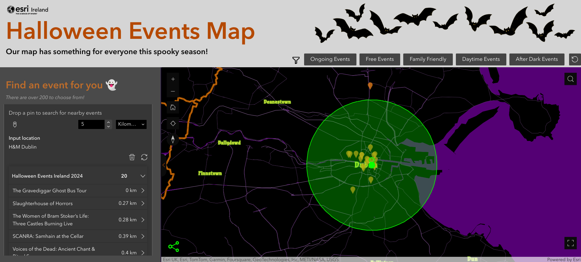
Esri Ireland, the market leader in Geographic Information Systems (GIS), has created a digital map of over 200 frightfully fun…

Esri Ireland, the market leader in geographic information system (GIS) technology in Ireland, has teamed up with the digital utility…

Esri Ireland, the market leader in geographic information systems (GIS), today announces that Galway County Council has digitally mapped over…

Esri Ireland, the market leader in Geographic Information Systems (GIS), is today announcing that its digital mapping system is being…

Galway County Council has received national recognition for an innovative digital project that mapped over 40,000 graveyard memorial records across…
Esri Ireland, the market leader in Geographic Information Systems (GIS), today announces that its digital mapping system is embedded in…

Esri Ireland, the market leader in Geographic Information Systems (GIS), is today announcing that its digital mapping system has delivered…

To meet the growing demand for spatial analytics, Esri is extending its long-standing strategic collaboration with Microsoft through a unified…

Esri Ireland, the market leader in Geographic Information Systems (GIS), has created a digital map showcasing the rich history, diverse…