Scientists deploy dairy drones to help farmers choose the best fields.

Irish farmers could soon be using hi-tech ‘dairy drone’ imagery and a form of artificial intelligence to help them decide which fields to let their cows graze.

Researchers at Teagasc, UCD and DCU, funded by the VistaMilk SFI Research Centre based in Teagasc, Moorepark, Co Cork, are currently testing the accuracy of physical and lab-based observations of grass growth against new image-analysing, machine-learning models based on photos captured by drones and static cameras. The aim is to produce predictive data of the yield and composition of grass growth on pastures. This innovation is designed to help farmers determine the best time and which areas to allow their cows feed.

To date, the predictive models based on a simple photograph are resulting in 95% accuracy rates when compared to physical observations.

Deirdre Hennessy, VistaMilk Funded Investigator and Senior Teagasc Research Officer, said that grass and pasture management is vitally important for the success of Ireland’s €5bn dairy industry.

Deirdre said: “It’s not as simple as letting the cows out to eat where and when they want. Farmers are constantly walking their fields monitoring grass growth, paying particular attention to its yield, composition, and its grazing suitability. They must determine when there are adequate quantities available to feed their animals while making sure they avoid having too much grass, leading to waste and poor quality or potentially under grazing.

“This is very labour intensive and time consuming, and the research that VistaMilk is funding is designed to provide them with that information more easily and quickly.”

“Image-analysing, machine-learning algorithms will work with pictures captured by drones – and even satellites in the future. The potential of what we can do in will only be limited by our imaginations. We can theoretically look at sending out drone swarms that will return their information to a base in a matter of minutes, giving farmers in a whole county the results that will allow them to make better business decisions while farming more sustainably.

“I personally think that would be some achievement and a sight to see, if and when it becomes viable. For now, we will continue to prove that our drone captured imaging algorithms work and will leave the scaling up to the next generation of researchers that are following closely behind.”

The quality of Irish dairy is, in large part, due to the fact that our cows are grass-fed. Currently 5,000 Irish farmers are using a grassland management app called PastureBase Ireland to input their physical observations of grass growth and get results by the time they are finished walking their land. However, there are many factors that can skew the outcomes, including, for example, the subjectivity of observations made by different people.

Deirdre added: “Knowledge of how your grass is growing and what else is in your paddock, such as clover, can make a huge difference to a farm’s profitability and sustainability. The imaging analysis work that is ongoing in VistaMilk and with our partners will make the process more accurate and automated, thereby making it easier for the farmer to make timely and correct decisions on how to manage their fields.”

Farmers who use PastureBase Ireland are already reducing the need to purchase supplemental food to feed their cattle. It is estimated that every tonne of extra grass grazed is worth in the region of €172 to a farm, which adds up to a substantial amount of money over the course of approximately 300 days of grazing each year.

Additionally, the improved understanding of the mix of grasses and other plants like white and red clover are reducing the requirement for artificial fertilisers and improving quality of winter silage. All the while resulting in increasing milk yields and quality of the end product manufactured in Ireland worth an estimated €5bn to the economy.

Deirdre concluded: “The ultimate goal is to create an app that uses a combination of physical observations, weather predictive models and automated grass imaging that will save time and money for the farmers.

“While we are not there quite yet the future is just around the corner.”

Skyports strengthens maritime drone delivery commercialisation efforts

Leading Advanced Air Mobility (AAM) infrastructure developer and drone operator Skyports has entered into two new commercial partnerships with Thome Group, a fully integrated ship management company, and Wilhelmsen Ships Agency, one of the worlds’ largest ships agents. Adding the reach and competencies of  Thome and Wilhelmsen will accelerate Skyports’ ambitions in bringing drone delivery services to Singapore’s bustling maritime sector.

With strong backing and partnerships, Skyports is on the path to full-scale commercialisation of maritime shore-to-ship delivery services and the concurrent development of the necessary infrastructure to support these services for all industry players in Singapore and beyond

Mr Yun-Yuan Tay, Head of APAC, Skyports said, “Skyports is proud to be working with some of the leaders in the shipping and maritime industry, and to have forward-looking partners like Wilhelmsen and Thome recognise the importance and relevance of using AAM in their operations. Looking ahead, we hope to continue developing the AAM industry in Singapore and the region to enhance processes in the maritime industry – by reducing delivery times and carbon emissions, providing a new transportation option that is both more efficient and more sustainable.”

Wilhelmsen and Thome are two of the biggest players in the maritime industry, managing ships and providing agency services for thousands of vessels in Singapore’s port every year.

Separate trials will see Skyports in close collaboration with Wilhelmsen Ships Agency and Thome Group, as well as the Maritime Port Authority (MPA) in Singapore, and other government agencies. Skyports will lead the development and testing of the Concept of Operations (ConOps) for Proof of Concept (PoC) operations for shore-to-ship drone deliveries, leading into the operationalisation of drone delivery services in the maritime sector.

Skyports’ trials will deploy Beyond Visual Line of Sight (BVLOS) deliveries from the temporary drone delivery distribution hub at the Maritime Drone Estate to vessels at pre-identified anchorages. Skyports is looking to complete up to 100 deliveries over the partnership period. 

“Wilhelmsen is excited to be working with Skyports to incorporate drone delivery option into our service offering,” said Ms Jodie Reibel , VP Governance & Sustainability for Wilhelmsen Ships Agency. “We are committed to exploring new opportunities in renewables, zero-emission shipping, and marine digitalization, and this partnership with Skyports is just one example of such collaborations. The use of drone technology and digitalisation of shore-to-ship deliveries would improve efficiency of our operations significantly, and offer our clients a more sustainable and convenient option.”


Mr Peter Schellenberger, Vice President, Supply Chain, Thome Group said, “Thome is continuously improving its services and offerings to enable customers to remain competitive in the maritime sector and is happy to be working with Skyports on this new collaboration. The company works closely with partners like Skyports to explore new technologies and methods to offer customers versatile solutions in ship management and offshore structure management. With the volume of cargo moving through Singapore’s port every day, the company sees the potential of the AAM industry to change the way the maritime sector operates and is looking forward to developing this further. Regulatory compliance is extremely important, and we work closely with our clients, suppliers, and principals to tackle important issues such as decarbonisation, sustainability, and governance. This forward-thinking approach has meant that the Thome Group is widely recognized as one of the world’s leading independent international ship managers.”

Mr Ng Yi Han, Director (Innovation, Technology & Talent Development), MPA said, “The agreements between Skyports and Wilhelmsen Ships Agency as well as Skyports and Thome Group are a testament to the potential of drone technology as they seek to develop drones for shore-to-ship deliveries in the unique operating environment of Singapore. The accelerating momentum for drone technology makes such partnerships important for both regulators and industry players to better understand how commercial operations can take place in our port environment to bring about commercial solutions that are effective and safe.”

Header image – The second contract signing ceremony took place between Skyports’ Head of APAC, Mr Yun-Yuan Tay (L), and Mr Peter Schellenberger (R), Vice-President, Supply Chain, Thome Group courtesy of Maritime and Port Authority of Singapore

How far can a drone fly?

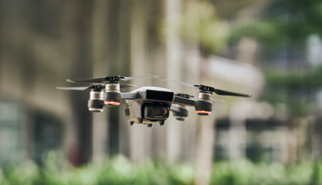
Drones have become very popular and are no longer reserved only for photographers. Now, many private homes own a drone because of its amazing filming abilities in the air. Drone range is the distance a drone can fly from the operator while still working properly. Those ranges are not always accurate when it comes to theory and real-life but they do give you an idea of how much your drone can fly. Drone range can vary from model to model and you want to pay attention to that info if the distance is an important factor for you when purchasing a drone.

There is also a law regulation that requires that you keep your drone in sight at all times for safety measures. Some drones can get to the distance of 5-8km which is great but can you keep it in sight that far away? More expensive drones come with a bigger available distance but you usually can’t utilize them without breaking the law regulations.

Obstacles and drones

You also need to consider the obstacles that may weaken the signal between drones and GPS satellites. Those could significantly shorten the previously indicated distance. What happens in this situation is the signal between drone and operator is lessened which can lead to a loss of a relationship. To prevent this from happening you need to do a thorough research of the environment that you’re gonna use your drone in. Check if there are any mountains that might interfere with the signal. Are there any trees that might affect your sight? You need to make sure that you can do this process safely and not end up with your drone running into the water or a three, or hurting someone.

Transmission system

If you wondered if a transmission system can affect a drone’s flying space, the answer is yes. If relations are weak between your drone control, GPS, and a drone itself there will be a significant impact on the flying space. The problem is that the drone will already fly a certain distance before alarming you that the signal is weak. If this happens return your drone. If you don’t it may happen that the drone flies off on itself or drop from the sky.

The controller range and safety

While toy drones won’t be able to fly a length of the football field, mid-ranged drones can get to 0.4km allowing you a good visual. The high-end drones allow you to fly your drone from 2.5 to 5km which is a notably bigger range than mid-ranged drones.

When you fly your drone to such a distance, it doesn’t matter if the drone can keep in contact that much, but if you can keep the visual? This is important because of the safety issues. At that distance, you won’t be able to tell if the drone is properly following your commands and you could even mix it up with a bird. The lack of a fantastic visual automatically means that safety regulations are not honored. You could endanger animals, humans, vehicles, and buildings. That is why FFA tips exist. Not to get fun away from you but to keep you and the rest of the location safe.

If you’re wondering why do they even exist then if we can’t fly them to that distance? Well, it’s because there are many professional uses for the drones and those are controlled by certified and accredited pilots. They can apply to FAA to run beyond visual line of sight.

Also, they would have the flight planned upfront so that visual is not necessary. That’s specifically often done for the agriculture fields, mapping, etc. For package shipping as a business in development, drone route is also automated with flight preparations.

Why should you choose a high-end drone for private purposes? Well, usually people do this because of the fact that longer rangeability ensures a good signal, no transmission problems, and better responsivity even on the nearer range.

What can happen when a drone gets out of the range?

Two types of drone ranges are the video signal range and the control range.

The control range drone will be able to fly since it works on a 2.4GHz range, while the live video input drone runs on a 5.8GHz range. With a live video drone, your movie feed will shed. After that, you will lose the screen connection and won’t be able to see the live video any longer. But remember that drones can still respond to your controls so just keep going without panicking.

If you don’t have a clear location with no obstacles or pre-planned flight, we suggest that you press the “return to house button” to avoid drone infraction or damaging buildings and vehicles, or even hurting people. Since you won’t have a video visual of your drone, any of these situations can happen in a diverse location. You can also return your drone a bit so you can pick up the movie feed again.

Some GPS drones have a failsafe built-in option that allows your drone to automatically come back home. In some situations, the drone will hover in the air which will give you the opportunity to come closer and regain control signal.

Another situation that may happen is that the drone lands down which is great unless it’s flying over the water or difficult to access location. The worst scenario is that your drone flies off and crashes into something. This can also happen when the drone is returning home over terrain with lots of obstacles.

Increasing your drone’s range

Here are several ideas you can try to increase your drone range:

Using FCC limits instead of the CE limitations (Europe)

Buy a better antenna for your controller or use an antenna extender

Use a more robust receiver for your drone

Purchase a range extender

Conclusion

When purchasing a drone don’t just focus on the bigger range but pay attention to safety measures and quality of the materials used for making a drone. Keep in mind that the usage of drones with installed cameras over private properties is forbidden.

Also, important to know is that radar can detect any communication type drone as well as the pre-programmed ones. FAA can track your drone and check the license plate number. It has access to your drone’s location, the direction of flight, and flying speed. If you want to use your drone in closed spaces, we recommend using an indoor DJI. If you are not quite sure what to look for when purchasing the drone for inside use, here you can find a nice selection of indoor DJI drone.

ST Engineering, Sumitomo and Skyports Join Forces to Use Unmanned Aircraft for Heavy Lift Shore-to-Ship Parcel Delivery

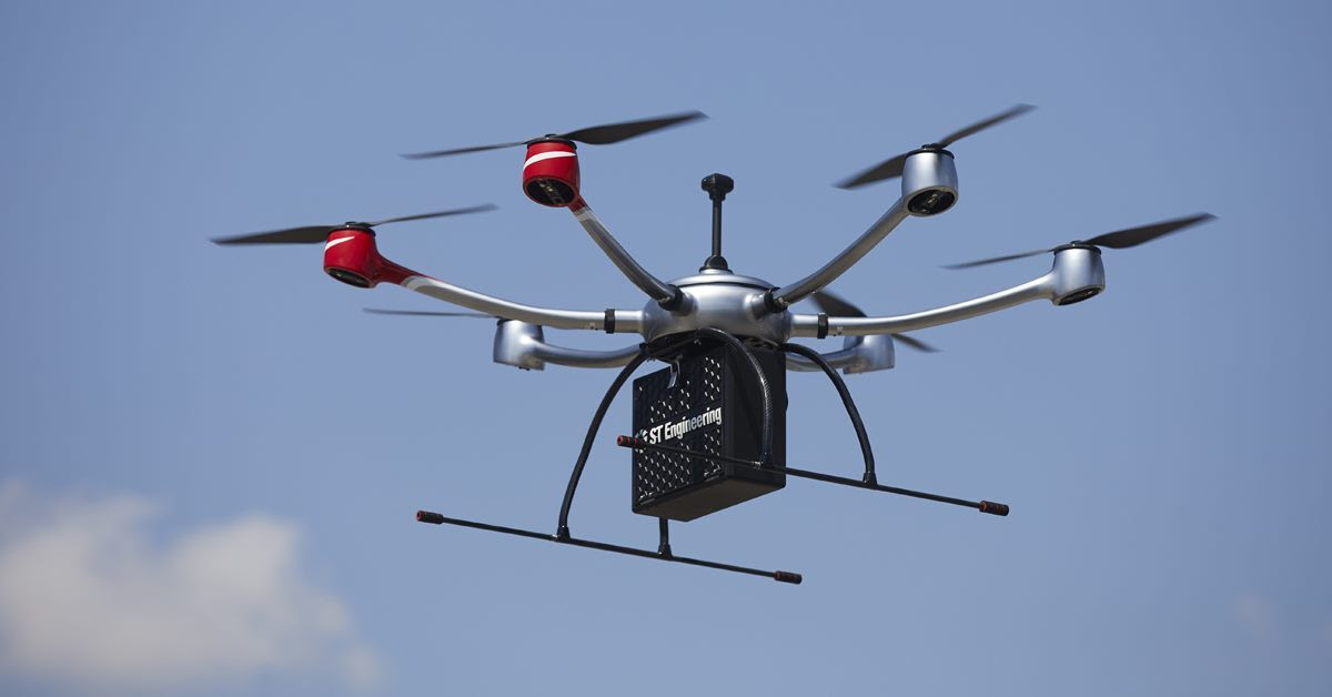
ST Engineering, Sumitomo Corporation and Skyports today announced the formation of a consortium to provide Unmanned Aircraft (UA) services for heavy-lift shore-to-ship parcel delivery in Singapore.

Each consortium member will exploit their respective operational and technological capabilities to expand the use of autonomous UA for the deliveries of maritime essentials to vessels at anchorage. During a nine-month pilot programme, the consortium will engage key customers for maritime UA deliveries, with the goal of establishing a UA delivery network capable of carrying parcel payloads of 10kg.

ST Engineering will provide the UA technology using its end-to-end solution – DroNet; Skyports will jointly conduct the Beyond Visual Line of Sight (BVLOS) flight operations with ST Engineering; while Sumitomo Corporation will provide go-to-market support, including their own fleet of vessels.

As a leading unmanned systems participant in Singapore, ST Engineering has been testing and developing autonomous solutions to enable BVLOS UA operations for shore-to-ship delivery in close collaboration with regulators and industry partners. Through funding support from the Civil Aviation Authority of Singapore’ (CAAS) Call-for-Proposals, the Group recently completed the initial development of an UA system for shore-to-ship parcel delivery based on its in-house DroNet solution.

Compared to the traditional form of delivery by boats, UA operations can significantly slash response time and speed up turnaround for shore-to-ship delivery, in addition to reducing logistics costs. Replacing launch boat delivery with UA also helps to reduce carbon emissions and contribute to the maritime industry’s overall efforts to operate sustainably.

Sanjay Suresh, Head of Business Development & Operations APAC at Skyports, said, “As home to one of the busiest ports in the world, Singapore is the ideal setting in which to demonstrate to customers the potential for unmanned aircraft to transform maritime logistics by moving essential supplies such as heavy shipping components and tools in a more cost-effective and sustainable way. Together with ST Engineering and Sumitomo Corporation, Skyports is excited to play a key role with our expertise in BVLOS unmanned aircraft operations in the continued expansion of our collective capabilities in the maritime sector.”

Teong Soo Soon, VP & Head of UA Systems at ST Engineering, said, “UA Systems have evolved rapidly in recent years to emerge as safe and robust alternatives to traditionally labour- and time-intensive missions. We are excited to be partnering Sumitomo Corporation and Skyports in the pilot launch of unmanned services for shore-to-ship parcel delivery after spending close to two years of R&D efforts to develop the solution. We look forward to being a strong enabler for customers which wish to leverage unmanned technology to inject higher efficiency and sustainability into their operations.”

Ichiro Tatara, GM, Commercial Aviation Department at Sumitomo, said, “UA systems are a potential infrastructure enabling sustainable transportation. We are very excited to launch a pilot programme for shore-to-ship parcel delivery together with ST Engineering and Skyports, and we believe this partnering is a great team and provides sustainable and efficient service to vessels in Singapore.”

ST Engineering is showcasing its UA systems and other aerospace capabilities at the Aviation cluster of the ST Engineering Pavilion (G01) from 15 – 18 February at Singapore Airshow 2022.

Skyports – Drone Deliveries Take Flight in First-of-its-Kind Trial in Ireland

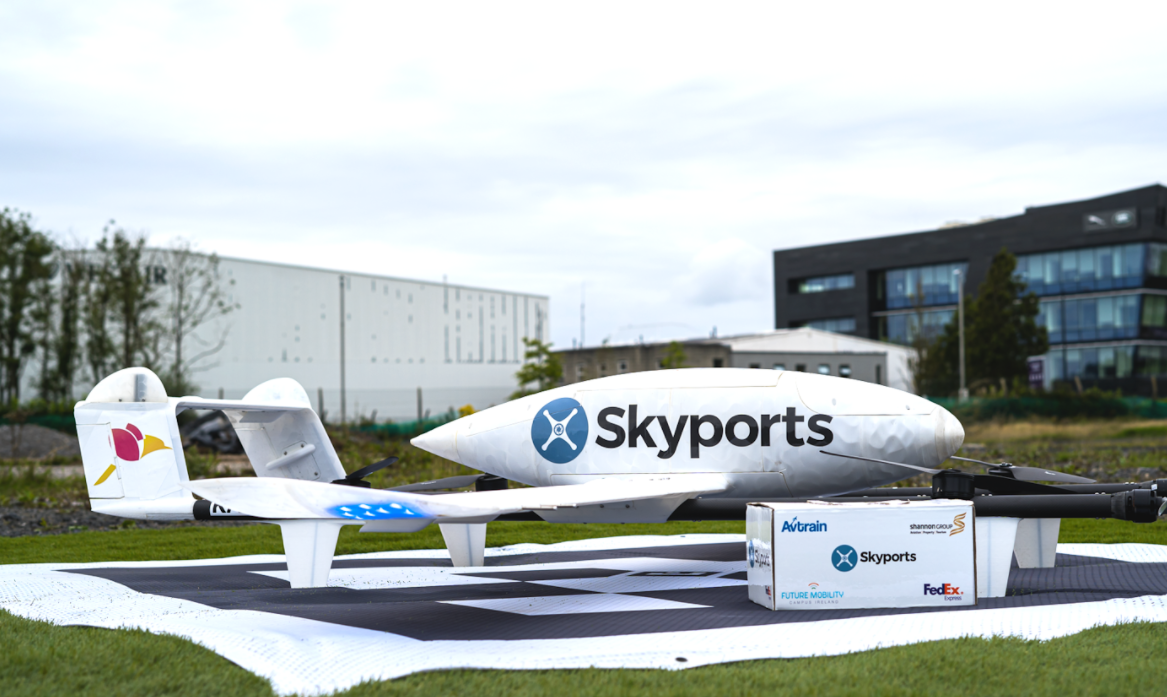
Testing last-mile drone delivery of goods between Shannon Airport to Foynes Port begins

Last week, FedEx Express, a subsidiary of FedEx Corp. (NYSE: FDX), and the world’s largest express transportation company, in collaboration with Future Mobility Campus Ireland (FMCI) Air, announced the completion of its first scheduled drone last-mile delivery flight in Ireland. The delivery marks the launch of a trial service delivering goods from FMCI, based at Shannon Airport, County Clare, to Foynes Port, County Limerick, Ireland’s second-largest port operator and largest bulk port company.

The drone deliveries were conducted by Skyports, a world-leading operator of cargo drone deliveries, on behalf of the FMCI Air consortium which also includes Avtrain, Shannon Group and FMCI.

The delivery of the first FedEx Express package in Ireland via drone demonstrates the benefits of drone delivery for last-mile service and the commitment by FedEx to exploring the latest innovations in last-mile delivery.

The delivery is part of a month-long trial which will see a number of test flights conducted in the Mid-West region, beyond visual line of sight (BVLOS) between Shannon Airport and Foynes Port, with deliveries anticipated to be made in under 13 minutes. Clare County and Limerick City and County Council have shown their support for the project, highlighting the role that the councils are playing and leading from an innovation perspective.

Mike Roche, Operations Managing Director, FedEx Express Ireland, said: “We are always looking for new and innovative ways to deliver the world to our customers’ doorsteps and I’m delighted that this drone delivery trial is underway and an example of how we, as an industry, continue to explore new technology to help meet our customers’ evolving delivery needs.”

Julie Garland on behalf of the FMCI Air Consortium, said The calibre of the partners involved in this trial ensures its success. To test the incorporation of Beyond Visual Line of Sight (BVLOS) drone freight deliveries into global supply chain logistics is the future happening now. The location of this trial from the FMCI base adjacent to Shannon Airport, in controlled airspace, with full air traffic control services demonstrates the integration of manned aircraft operations with simultaneous vertiport drone operations becoming the norm and paving the way for Advanced Air Mobility.”  

More information about FedEx technology and innovation is available at fedex.com/technology.

Tech Review – The Eachine E520s 720p drone. Great for starting off with. #Drones #Tech

I am no drone expert so lets get that out of the way nor claim to be one however I am seeing many people in the tech world touring €400 is what you call an affordable drone which is utter bullshit. OK the brand in question is DJI that make good drones dont get me wrong but the constant push at €400 and affordable is BS and should be ignored unless you are using in a professional capacity and have being flying drones before and have had the practice of their basic functions before you go and shed out big money on the more expensive ones.

Drones come in all shapes and sizes and of course price point and can be picked up cheap as the one in this review for example. If you are new to drones start out on the smaller cheap scale to get the skills to understand how they work rather than shell out and lose your affordable €400 drone and be pissed off for a long time over it, At least loosing a cheap drone is not a big deal and a fraction of the price.

This drone comes in several variants and all cheap but can go up much higher and here is where to start. I have lost a drone and I know many other who have only my first drone loss was non expensive and I got over it however I know some folk who have lost expensive ones going in with the expert approach and never flew a drone before and I just laugh.

This drone has all the features of more expensive drones bar the camera quality and it is sufficient to have fun and learn the basics before you move up to more expensive gear, As with many drones battery life is the problem but you can purchase separate batteries to have longer sessions and fun and get shots you could never do otherwise and drones are a new approach to getting things done in more ways than one. You can configure your package here with this drone with battery quantity,camera quality and more which I think is great.

It is simple to setup use and learn the basics with easy to use controls on the joypad or use the on screen controls from your smartphone with basis toggles again on both to capture images,record videos and do basic commands controlling it. This is a first of several drones I will be checking out and this time around I had brutal weather and it was windy which made it hard to get good stabilised footage but I went out to see what it was capable of doing in such conditions and the results are good given the poor camera on this but the day footage is good enough and a great way to get started before you get the skills and knowledge built up and shed out truck loads of money for the likes of DJI and so on.

Features:

– With foldable arm, small size, easy to carry.
– GPS positioning mode provides a more accurate flight.
– With 5G / 2.4G wifi function can be connected APP, APK system to take pictures/video, real-time transmission through the phone camera image
– 5G wifi fpv distance up to 250m.
– Optional 720P / 2.4G WiFi 1080P / 5G WiFi 1080P / 2.4G WiFi 4K HD / 5G WiFi 4K HD camera give wide range high denfinition pictures and video.
– Follow me: the aircraft will fix the controlling cellphone and follow the operator whichever direction he moves.
– With altitude hold mode function provides stable flight.
– Surround action will enable the aircraft flying in a circle, providing cooler shooting perspective.
– Waypoint flight mode, just draw a route on the screen, the copter as the give path.
– With 7.4V 1200mAh battery, the fly time up to 16 mins.
– With Headless Mode,no need to adjust the position of aircraft before flying .
– With One key to return function makes it easily to find the way home.
– One Key Takeoff /Landing. One press automatically taking off or landing, the drone will take off or go back to the position where it took off.
– With low power protection overcurrent protection.
– 2.4GHz Technology Adopted for Anti-Interference.
– 4 Channel which can do ascend, descend, forward, backward, left sideward fly, right sideward fly.
– 6-axis g-yro which can have more stable flying and be easy to control.
– It have 3-level flight speed to switch that can make more fun with the flying.
– The quadcopter fuselage is made of high strength and resistant engineering plastics,lightweight and durable resistance.

Function: Up/down, Forward/backward, Turn left/right, Sideward flight, 3-level flight speed, LED Light, GPS Positioning, Follow Me, Surrounding Flight, Waypoint Flight, Altitude Hold Mode, Headless Mode, One Key Return, One Key Takeoff /Landing, WiFi FPV, Camera/Video

Check out this link for extra discounts

BUY HERE